Selecting the perfect hiking trail requires more than simply choosing a destination that looks appealing in photographs. The intersection of personal ability, trail characteristics, and environmental conditions determines whether your outdoor adventure becomes a memorable achievement or a potentially dangerous ordeal. Understanding how to evaluate these factors systematically transforms trail selection from guesswork into a strategic decision-making process that enhances both safety and enjoyment.
Modern hiking has evolved into a sophisticated pursuit where technology, scientific assessment methods, and traditional outdoor wisdom converge to create comprehensive evaluation frameworks. The days of relying solely on word-of-mouth recommendations or basic guidebook descriptions have given way to detailed grading systems, precise elevation data, and real-time condition monitoring. This evolution reflects the growing recognition that proper trail matching significantly reduces accidents whilst maximising the psychological and physical benefits of outdoor recreation.
Trail difficulty classification systems and grading methodologies
Understanding various trail classification systems provides the foundation for making informed decisions about route selection. Different regions employ distinct grading methodologies, each reflecting local terrain characteristics and hiking traditions. These systems serve as universal languages that transcend geographical boundaries, allowing hikers to assess unfamiliar routes with confidence.
The complexity of modern trail grading extends beyond simple easy-moderate-difficult categories. Contemporary systems incorporate multiple variables including technical difficulty, exposure levels, route-finding challenges, and objective hazards. This multidimensional approach acknowledges that hiking difficulty cannot be captured by a single metric, requiring instead a comprehensive evaluation framework that addresses diverse skill sets and risk tolerances.
Understanding the yosemite decimal system for technical rock approaches
The Yosemite Decimal System (YDS) provides precise classification for routes involving technical rock sections. Within the hiking context, the system primarily utilises Class 1 through Class 3 ratings, where Class 1 represents well-maintained trails requiring no technical skills, whilst Class 3 involves scrambling with significant exposure where falls could prove fatal.
Class 2 terrain, often encountered on alpine approaches, requires careful attention to route-finding and occasional use of hands for balance. The distinction between upper Class 2 and lower Class 3 represents a critical threshold where hiking transitions into technical climbing. Understanding these nuances proves essential for routes in mountainous regions where trail conditions can vary dramatically within short distances.
European alpine club Colour-Coded trail marking standards
European hiking regions employ sophisticated colour-coding systems that provide immediate visual assessment of trail difficulty. The standard system utilises blue markings for easy valley walks, red for moderate mountain trails, and black for difficult alpine routes requiring mountaineering skills. This system extends beyond simple difficulty ratings to incorporate seasonal accessibility and equipment requirements.
The Alpine Club system particularly excels in addressing exposure concerns, with specific markings indicating sections where falls could result in serious injury. Routes marked with white-red-white blazes typically indicate well-maintained paths suitable for experienced hikers, whilst white-blue-white markings suggest easier terrain appropriate for families. This visual system enables rapid assessment of route suitability without requiring detailed map consultation.
SAC hiking scale assessment for swiss alpine routes
The Swiss Alpine Club (SAC) hiking scale represents one of the most comprehensive trail assessment methodologies globally. The six-level system (T1-T6) incorporates technical difficulty, physical demands, route-finding challenges, and objective hazards into a unified rating framework. T1 trails require no special skills and follow well-marked paths, whilst T6 routes demand expert mountaineering abilities and extensive alpine experience.
The SAC system particularly emphasises the relationship between technical demands and consequences of error. T3 routes, for example, may involve exposed scrambling where careful movement prevents accidents, whilst T4 terrain requires climbing skills and specialised equipment. This systematic approach enables precise matching of route difficulty with individual capabilities, significantly reducing the likelihood of exceeding safe limits.
National trail database difficulty ratings and regional variations
National trail databases increasingly incorporate standardised difficulty metrics that account for regional terrain variations. These systems typically combine distance, elevation gain, technical complexity, and seasonal factors into comprehensive ratings that facilitate comparison across diverse geographical areas. The integration of user feedback and GPS tracking data enhances the accuracy of these assessments.
Regional variations in rating systems reflect local
Regional variations in rating systems reflect local expectations about what constitutes a “normal” hiking day. A route labelled “moderate” in a steep alpine valley may feel significantly harder than a “moderate” coastal path of similar length, simply because of gradient, exposure, and weather patterns. When you use national trail databases, always look beyond the label and examine the underlying metrics: total distance, cumulative elevation gain, surface type, and any notes about scrambling or route-finding. Cross-referencing these objective measures with your own experience allows you to calibrate each region’s grading system to your personal benchmark and choose picturesque trails that genuinely match your level.
Physical fitness assessment and technical skill evaluation
Matching a hiking trail to your ability requires more than ambition and enthusiasm; it demands an honest assessment of your current physical capacity and technical skills. Rather than guessing what you can handle, you can rely on measurable indicators that translate directly into safe route choices. The goal is not to reduce hiking to numbers but to use those numbers as guardrails, ensuring that scenic, challenging routes remain within your safe operating zone.
Systematic self-assessment helps you differentiate between a trail that will stretch you in a positive way and one that will leave you exhausted, stressed, or exposed to unnecessary risk. By understanding where your cardiovascular fitness, joint stability, core strength, and technical competencies really stand, you can approach trail descriptions and grading systems with clarity. This process also reveals specific areas where focused training will unlock access to more ambitious, high-reward routes over time.
VO2 max testing and cardiovascular endurance benchmarks
VO2 max, the maximum rate at which your body can utilise oxygen during intense exercise, provides a robust indicator of cardiovascular endurance. Laboratory VO2 max tests remain the gold standard, but many modern GPS watches now estimate VO2 max based on your running or brisk walking data. While these numbers are approximations, they offer useful benchmarks when you are planning longer or higher-altitude hikes that require sustained effort.
For most recreational hikers, a VO2 max in the “average” to “good” range for their age group is sufficient for day hikes up to 15–20 kilometres with moderate elevation gain. If your VO2 max sits at the lower end of the scale or you find yourself short of breath on short stair climbs, it makes sense to choose easier routes with minimal ascent and plenty of turnaround options. As your aerobic fitness improves through regular walking, interval training, or cycling, you will notice that trails once deemed “strenuous” on paper start to feel comfortably manageable.
Ankle stability and proprioceptive balance requirements
Picturesque trails often involve uneven surfaces, loose stones, and narrow traverses where a simple misstep can lead to a sprain. Ankle stability and proprioception—the body’s ability to sense joint position—are therefore critical for safe movement on technical terrain. You can quickly evaluate your baseline by attempting simple balance tests at home, such as standing on one leg for 30 seconds with eyes open and then closed. Difficulty maintaining stability in these scenarios signals a need for targeted strengthening before committing to rocky or root-filled paths.
Trails with scree slopes, boulder fields, or frequent side-hilling demand particularly strong ankles and responsive balance. If you know your ankles are vulnerable or you have a history of sprains, prioritise routes described as “well-graded” or “smooth forest path” in trail databases. Incorporating proprioceptive exercises into your training—such as balance boards, single-leg squats, and lateral band walks—can significantly improve joint resilience, gradually opening the door to more rugged alpine approaches and panoramic ridge walks.
Core strength assessment for steep gradient navigation
Core strength plays a pivotal role in maintaining efficient posture on steep gradients, both ascending and descending. A weak core forces your lower back and knees to absorb excessive strain, especially when carrying a loaded backpack on long hikes. Simple assessments—such as holding a plank for 45–60 seconds with good form or performing controlled step-ups while keeping your torso upright—offer practical insights into your readiness for trails with sustained elevation gain.
On demanding routes with sharp climbs, tight switchbacks, or loose descents, strong core engagement stabilises your spine and allows your legs to generate power without compromising alignment. If you struggle to maintain posture under load, prioritise flatter or rolling terrain while integrating strength work into your weekly routine. Over time, an improved core will not only reduce the risk of overuse injuries but also make long days in mountainous landscapes feel smoother and more enjoyable.
Previous hiking experience documentation and skills inventory
Documenting your previous hiking experience transforms vague memories into actionable data. Keeping a simple log of distance, elevation gain, total time, terrain type, and perceived exertion for each outing allows you to identify your practical limits under real-world conditions. You may notice, for example, that hikes with more than 700–800 metres of ascent leave you fatigued, or that technical scrambling above a certain exposure level affects your confidence and pace.
Alongside quantitative information, compile a skills inventory: navigation competence, comfort with river crossings, experience on snow or ice, and familiarity with using trekking poles or microspikes. When you read that a spectacular alpine circuit includes “short, exposed scrambling sections and intermittent snowfields,” you can immediately compare these requirements with your documented experience. This alignment between objective trail descriptions and your personal history is one of the most reliable ways to ensure that scenic routes remain within your operational comfort zone.
Geographical terrain analysis and route selection criteria
Every landscape tells a different story, and understanding the terrain helps you choose routes where the scenery aligns with your abilities. Geographical terrain analysis goes beyond admiring photos of lakes and ridgelines; it involves interpreting topographic maps, satellite imagery, and trail profiles to understand how those views are earned. A route that appears gentle in a single photo may, in reality, involve a steep, loose gully or an exposed traverse that does not match your current skill set.
When analysing potential trails, focus on a few key criteria: slope angle distribution, surface composition, and exposure to objective hazards such as rockfall or river crossings. Topographic maps reveal not only total elevation gain but also how that gain is distributed—short, steep bursts versus long, gradual climbs. Satellite imagery can indicate whether you will be moving through dense forest, open moorland, or broken rocky terrain. By integrating these data points, you can filter out routes whose underlying geology and structure would significantly increase risk or fatigue, while prioritising picturesque options that harmonise with your technical comfort zone.
Elevation gain calculations and acclimatisation planning
Elevation gain is often the hidden variable that transforms an apparently simple hike into an unexpectedly demanding undertaking. Two trails of similar distance can feel dramatically different if one involves a gentle riverside path and the other climbs relentlessly through steep switchbacks. Calculating total and cumulative elevation gain allows you to estimate energy expenditure, time on trail, and the physiological stress your body will experience, especially at higher altitudes where oxygen availability decreases.
Thoughtful elevation planning is particularly important when your goal is to enjoy scenic, high-level routes rather than simply endure them. By understanding both the vertical profile of your chosen trail and your previous response to similar climbs, you can determine whether a route falls within your sustainable range. This calculation becomes even more critical when you move above 2,500 metres, where acclimatisation and altitude sickness risk must be factored into your itinerary.
Altitude sickness risk assessment above 2,500 metres
Above approximately 2,500 metres, the risk of acute mountain sickness (AMS) increases as barometric pressure drops and oxygen becomes less available. Even fit hikers can experience headaches, nausea, dizziness, or unusual fatigue if they ascend too rapidly. When you are evaluating high-altitude trails, consider not only the maximum elevation but also how quickly you will reach it from your starting point. A route that jumps from 1,500 to 3,000 metres in a single day carries a significantly higher risk than a multi-day itinerary that allows gradual adaptation.
To manage this risk, many mountaineering organisations recommend limiting daily sleeping altitude gains to 300–500 metres once you are above 2,500 metres, with a rest or acclimatisation day every 3–4 days. For hikers planning picturesque high passes or summit viewpoints, this principle translates into conservative route choices and flexible schedules. If your experience at altitude is limited, begin with moderate elevation objectives and pay close attention to how your body responds, adjusting your trail ambitions accordingly.
Cumulative elevation gain vs distance ratio analysis
The ratio of cumulative elevation gain to distance offers a simple yet powerful indicator of a trail’s physical demand. A 10-kilometre route with 300 metres of ascent presents a very different challenge from a 10-kilometre route climbing 1,000 metres, even though the distance is identical. As a rule of thumb, many hikers find that more than 100 metres of ascent per kilometre (roughly 500 feet per mile) indicates a steep, strenuous outing that requires solid conditioning and pacing.
When comparing potential routes, calculate this ratio to see how “steep per kilometre” each option is. This metric allows you to quickly identify trails that may be deceptively hard despite modest distances, particularly in mountainous regions. For most recreational hikers seeking enjoyable scenic days rather than maximum exertion, targeting routes with moderate ratios—perhaps 40–70 metres of ascent per kilometre—strikes a balanced compromise between effort and reward.
Descent knee impact calculations and joint stress management
While ascents may feel more taxing on your lungs, long descents often inflict the greatest stress on your knees and hips. Biomechanical studies suggest that downhill walking can generate forces up to three times your body weight through the knee joint, especially on steep gradients with unstable surfaces. This cumulative impact becomes significant on routes with large net descents or repeated undulations that require you to lose and regain altitude multiple times.
To manage joint stress, factor total descent into your planning just as carefully as total ascent. A route that climbs 800 metres and then drops 1,500 metres may be less suitable for hikers with knee sensitivities than a balcony trail that undulates gently along a valley side. Strategic use of trekking poles, appropriate footwear, and conservative daily distance targets all contribute to keeping your joints healthy. If you know that long downhills aggravate old injuries, prioritise loop routes with shorter descents or consider using cable cars and public transport to reduce impact-heavy sections.
Weather pattern research and seasonal trail conditions
Weather transforms the character of a trail as dramatically as distance or elevation. A benign summer path can become treacherous under snow, ice, or heavy rain, and a breezy ridge may turn into a serious hazard in gale-force winds. Effective trail selection therefore includes rigorous research into local weather patterns and seasonal trail conditions, rather than relying on average climate charts alone. The goal is to understand not only what the weather usually does, but also how quickly conditions can change in your chosen region.
Before committing to a route, consult multiple weather sources, including mountain-specific forecasts that account for altitude, wind chill, and storm risk. In many alpine areas, afternoon thunderstorms are common in summer, making early starts crucial for exposed passages. Seasonal factors such as lingering snowfields, avalanche risk, swollen rivers, or muddy, erosion-prone sections must also be considered. By aligning your trail choice with both the calendar and the forecast, you significantly increase the odds that your picturesque outing remains comfortable, safe, and photogenic rather than cold, wet, or hazardous.
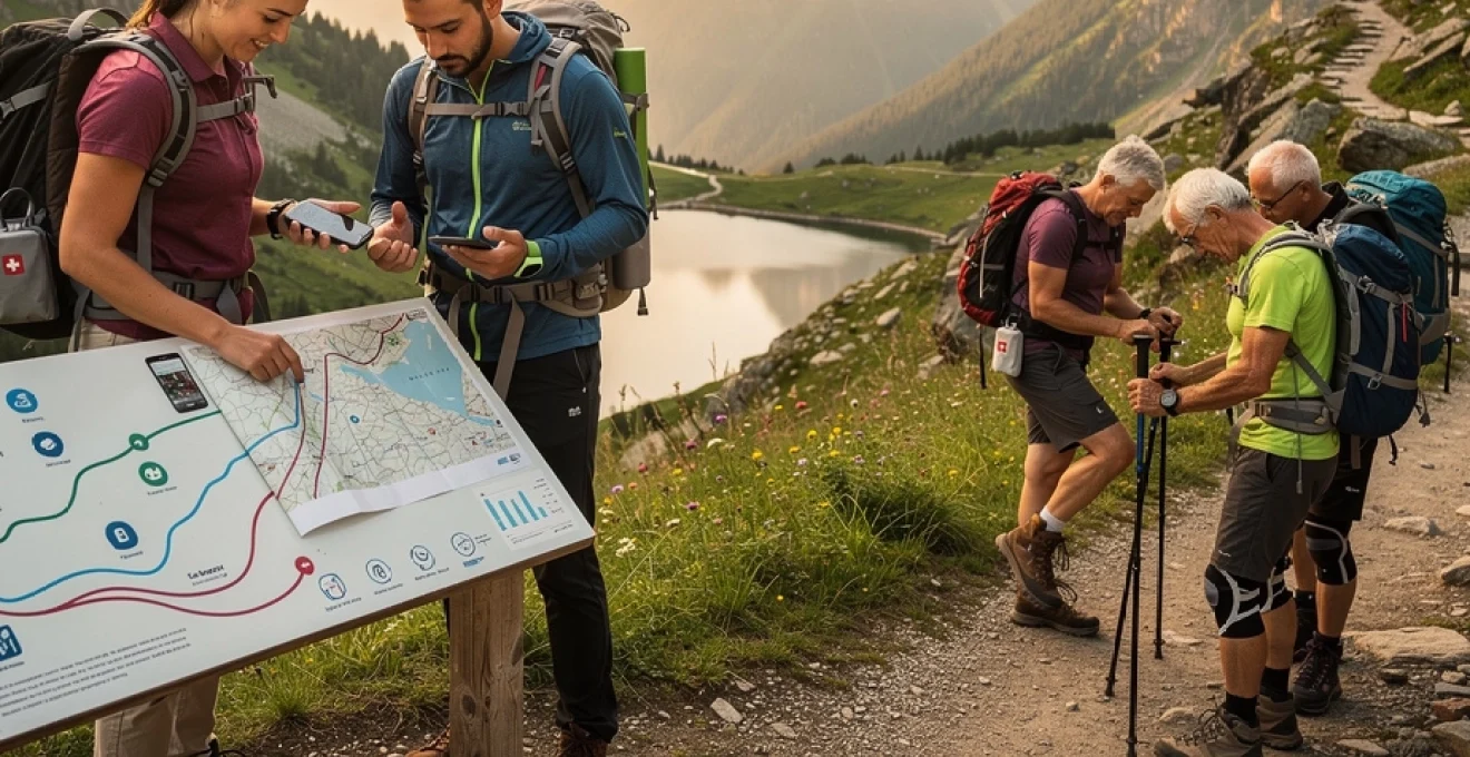
Essential navigation technology and emergency preparedness protocols
Modern navigation tools and emergency systems have revolutionised backcountry safety, but they are only effective when integrated into a coherent plan. Relying solely on a smartphone app without understanding its limitations is as risky as venturing out with only a paper map you cannot interpret under pressure. A balanced approach combines robust primary navigation (digital or analogue) with redundancies and clear emergency protocols, ensuring that you can respond calmly if visibility drops, batteries fail, or you are forced to alter your route.
Emergency preparedness begins long before you leave the trailhead. Sharing your intended route and return time with a responsible contact, carrying appropriate communication devices, and tailoring your first aid kit to expected hazards all reduce vulnerability. The more remote or technical your chosen trail, the more critical these systems become. By treating navigation and emergency planning as core components of trail selection, rather than afterthoughts, you can enjoy complex, scenic routes with the confidence that you have multiple layers of protection in place.
GPS device selection: garmin etrex vs suunto traverse capabilities
Dedicated GPS devices such as the Garmin eTrex series and Suunto Traverse offer significant advantages over smartphones in terms of battery life, reception, and durability. The Garmin eTrex line is renowned for its robust build, user-replaceable batteries, and strong satellite reception under tree cover, making it well-suited for long-distance trekking and remote forested routes. Suunto Traverse models, on the other hand, integrate GPS functionality into a wristwatch form factor, combining navigation with altitude profiles, barometric data, and basic weather trend indicators.
When choosing between these devices, consider how you typically navigate. If you prefer a dedicated handheld unit with detailed topographic mapping and the ability to swap batteries in the field, the eTrex platform is often the more practical choice. If you value constant wrist-based access to elevation and track recording, and you tend to hike in areas with easier exit options, a Suunto Traverse may suffice. In both cases, treat the GPS as an aid rather than a crutch by carrying a paper map and basic compass skills as a non-digital backup.
Offline mapping applications: OS maps and AllTrails pro features
Smartphone applications have become powerful tools for planning and navigating picturesque hiking trails, particularly when used with offline mapping features. OS Maps, for example, provides detailed Ordnance Survey cartography for the UK, including rights of way, contour lines, and access land boundaries. AllTrails Pro extends its global trail database with the ability to download route maps, view elevation profiles, and receive off-route alerts when you stray from your planned track, all without an active data connection.
To use these tools effectively, download your maps and routes to your device before leaving reliable connectivity. Think of offline mapping like printing your own digital guidebook tailored to your hike. Keep in mind, however, that smartphones are vulnerable to battery drain, cold temperatures, and impact damage. Carry a power bank, enable battery-saving settings, and store your phone in a protective, weatherproof case. When you pair these precautions with traditional navigation methods, you gain a flexible, redundant system that supports confident route finding without over-reliance on a single device.
Emergency communication devices: personal locator beacons and satellite messengers
In remote or mountainous regions where mobile coverage is unreliable, personal locator beacons (PLBs) and satellite messengers provide critical lifelines. PLBs are simple, dedicated emergency devices that, when activated, transmit a distress signal and your location via satellite to rescue coordination centres. They do not require subscriptions and have no messaging capability, but their focus on emergency signalling makes them extremely reliable for worst-case scenarios.
Satellite messengers, such as those using the Iridium or Globalstar networks, add two-way communication, allowing you to send predefined check-in messages, share tracking links, or exchange brief texts with contacts or rescue services. The ability to reassure loved ones or receive updated instructions can be invaluable when plans change or minor issues arise. When selecting a device, weigh the cost of subscriptions against the remoteness and seriousness of your typical routes. For multi-day treks far from help, a PLB or satellite messenger converts a potentially life-threatening isolation into a manageable, monitored situation.
First aid kit customisation for trail-specific hazards
A well-considered first aid kit is more than a generic collection of bandages; it is a tailored response system for the specific risks you are likely to encounter on your chosen trail. For rocky alpine routes with scrambling, you may prioritise wound cleansing supplies, blister management, and compression bandages for sprains. For hot, exposed desert trails, burn dressings, electrolyte replacements, and sun protection become more prominent components. The aim is to anticipate realistic scenarios rather than preparing for every hypothetical emergency.
Start with a compact, quality base kit and then customise it according to terrain, remoteness, group size, and known medical conditions. Include any personal medications, plus items such as anti-inflammatory tablets, antihistamines, and tape for joint support if you are prone to strains. Just as important as the contents is your familiarity with them; basic first aid training ensures that when something does go wrong, you can act decisively rather than fumbling with unfamiliar gear. This combination of targeted equipment and practical knowledge allows you to explore picturesque, challenging trails with a safety net that is both realistic and efficient.