Urban transit systems form the arterial networks of the world’s most populous cities, connecting millions of commuters daily across vast metropolitan landscapes. From the labyrinthine depths of Tokyo’s multi-layered rail network to the historic tunnels of London’s Underground, each subway system presents unique challenges and opportunities for both residents and visitors. Mastering these underground networks requires understanding their distinctive operational patterns, payment systems, and navigational quirks that can transform a bewildering journey into an efficient transportation experience.
Modern subway systems have evolved far beyond simple point-to-point transportation, incorporating sophisticated technology, complex interchange networks, and varied service patterns that reflect each city’s unique geography and development history. The intricacies of platform numbering, fare structures, and real-time information systems can initially overwhelm even seasoned travellers, yet these same complexities often provide the flexibility and coverage that make urban rail networks indispensable for metropolitan mobility.
Tokyo metro and JR network navigation strategies
Tokyo’s rail system represents one of the most comprehensive yet complex transportation networks globally, comprising two primary underground operators alongside the extensive Japan Railways (JR) network. The Tokyo Metro operates nine lines serving central Tokyo, while the Toei Subway manages four additional lines, creating an intricate web of connections that can transport passengers virtually anywhere within the metropolitan area. Understanding the distinction between these operators proves crucial for efficient navigation, as each maintains separate fare structures and ticketing systems despite their interconnected nature.
The dual-operator system requires travellers to purchase compatible tickets or utilise integrated payment methods to avoid fare complications. While both systems accept IC cards, paper tickets purchased for one operator may not provide seamless transfers to the other network. This operational complexity reflects Tokyo’s historical development, where multiple private companies developed parallel services before eventual coordination efforts created today’s partially integrated system.
Yamanote line integration with underground metro systems
The JR Yamanote Line functions as Tokyo’s central circulation system, creating a 34.5-kilometre loop that connects 29 major stations throughout central Tokyo. This elevated railway serves as the backbone for the entire metropolitan rail network, providing crucial interchange points with subway lines at stations such as Shimbashi, Tokyo, and Ikebukuro. Understanding Yamanote Line operations enables travellers to navigate efficiently between different districts without relying exclusively on underground networks.
Key interchange stations along the Yamanote Line offer connections to multiple subway lines, creating strategic transfer points for cross-city journeys. Tokyo Station alone provides access to five different subway lines alongside numerous JR services, while Shinjuku connects to three subway lines plus extensive JR regional services. These major hubs often feature multiple levels and platforms, requiring careful attention to directional signage and platform announcements to avoid confusion during transfers.
IC card technology: suica and pasmo payment methods
Suica and Pasmo cards represent the pinnacle of contactless payment technology for Tokyo’s transit systems, offering seamless integration across all rail operators, buses, and even retail establishments throughout the metropolitan area. Both cards function identically within Tokyo, though Suica originates from JR East while Pasmo was developed by private railway companies. These rechargeable cards eliminate the need for paper tickets and automatically calculate optimal fares across different operators.
The cards’ tap-and-go functionality extends beyond transportation, enabling purchases at convenience stores, vending machines, and restaurants throughout the city. Recent technological advances have integrated these payment systems with smartphone applications, allowing digital wallet functionality that provides real-time balance information and automatic recharging capabilities. Foreign visitors can obtain tourist versions of these cards at major stations, though standard cards remain available at automated machines with English language options.
Platform numbering systems at shinjuku and shibuya stations
Shinjuku Station’s platform numbering system exemplifies the complexity inherent in Tokyo’s largest interchange hubs, with numbered platforms scattered across multiple levels and operators within the same facility. JR platforms occupy numbers 1-16 for various lines, while subway platforms maintain separate numbering schemes that can create confusion for unfamiliar travellers. The station’s sheer scale encompasses over 200 exits, requiring specific platform and exit knowledge for efficient navigation.
Shibuya Station presents similar navigational challenges with its multi-level structure accommodating JR lines, three subway operators, and private
railway companies, each with their own concourses and ticket gates. To navigate Shibuya effectively, you should first identify whether your journey involves JR, Tokyo Metro, or private lines such as the Tokyu network, then follow colour-coded signage that indicates each operator. Platform numbers are often grouped by operator rather than following a single continuous sequence, so confirming both the line name and platform number on overhead signs is essential. When transferring between the famous Hachiko Exit area, the Shibuya Scramble Crossing, and underground metro platforms, allow extra time to follow directional arrows and overhead maps that guide you through connecting passageways.
Both Shinjuku and Shibuya make extensive use of bilingual signage, floor markings, and line symbols to help passengers orient themselves quickly, even during crowded periods. You will often see station staff assisting passengers, and many exits are labelled with nearby landmarks such as department stores or major streets rather than just numbers. Treat these large hubs like small cities: decide in advance which exit you need, check the line colour and letter combination, and verify platform numbers on electronic departure boards before boarding. This structured approach reduces confusion and helps you avoid backtracking through busy concourses.
Rush hour protocols and oshiya passenger management
Tokyo’s rush hour protocols are a defining feature of its subway culture, particularly on central lines like the Yamanote and Ginza Lines between 7:30 and 9:00 in the morning. During these periods, train frequency can be as high as one train every two to three minutes, yet carriages still reach capacity. Station staff, sometimes referred to as oshiya or “pushers,” help manage passenger flow by encouraging riders to move deeper into the carriage and ensuring doors can close safely. While this practice might seem intense to first-time visitors, it is carefully controlled and focused on safety and efficiency.
As a visitor, the best strategy for navigating rush hour is to avoid peak times where possible, especially if you have luggage or are not yet familiar with the network. If you must travel during busy periods, stand to the side of the doors to let passengers exit first, then board promptly and move away from the entrance area. Priority seating is clearly marked, and you should avoid using it unless you qualify or the carriage is otherwise empty. Keeping backpacks in front of you and minimising phone use while boarding helps maintain the orderly flow that keeps Tokyo’s crowded trains running on time.
Transfer techniques between JR east and tokyo metro lines
Transferring between JR East and Tokyo Metro lines can feel like changing countries without leaving the station, as each operator maintains its own ticket gates and concourse design. When using an IC card such as Suica or Pasmo, transfers become largely seamless: you simply tap out of one system and tap into the other, with the fare automatically calculated in the background. If you are travelling with paper tickets, you must ensure you purchase either a through-ticket that includes both operators or be prepared to buy a separate ticket after exiting the first set of gates. This is where understanding your full route in advance saves time and confusion.
Key interchange hubs like Tokyo, Shinjuku, and Ikebukuro provide clearly marked “Transfer” corridors connecting JR and Tokyo Metro areas, often with overhead diagrams showing which exits lead to which lines. Look for bilingual signs that combine the JR logo with the Tokyo Metro “M” symbol and arrows indicating walking times between platforms. A useful technique is to follow the line colour and letter rather than relying solely on station names, particularly when multiple lines share partial names or destinations. By thinking of the network as layers—JR above, Metro below—you can plan vertical as well as horizontal movement, reducing unnecessary detours in complex stations.
London underground tube map interpretation and zone fare structure
The London Underground, widely known as the Tube, is both a transport network and a design icon, thanks to its schematic map and clearly defined fare zones. Rather than reflecting precise geography, the Tube map prioritises readability, stretching and compressing lines to make interchanges and routes easier to understand. For visitors, this means that stations that appear close on the map may actually be a longer walk in reality, and vice versa. The city is divided into concentric fare zones from Zone 1 in central London out to Zone 9, with most tourist attractions located within Zones 1 and 2.
Understanding the zone fare structure is essential for cost-effective travel, especially if you plan to use the Underground multiple times per day. Fares are calculated based on the zones you travel through and the time of day, with peak pricing applying on weekdays during the morning and evening rush hours. Daily capping limits how much you pay in total when using Oyster or contactless payment, often making unlimited daily travel within specific zones more affordable than single tickets. By planning your itinerary to cluster attractions within neighbouring zones, you can minimise unnecessary crossings into higher fare areas and keep your overall transport budget under control.
Oyster card and contactless payment integration
Oyster cards remain a cornerstone of London’s public transport payment system, providing a reloadable, contactless way to pay for Tube, bus, and rail journeys. In recent years, contactless bank cards and mobile wallets have been fully integrated into the system, allowing you to tap in and out using the same gates as Oyster users. Both methods benefit from daily and weekly fare capping, meaning you will not be charged more than the cost of a corresponding Travelcard for the zones you use. For many visitors, bringing a contactless-enabled bank card or smartphone is now as convenient as purchasing a dedicated Oyster card.
When deciding between Oyster and contactless, consider whether you already have a card that avoids foreign transaction fees and whether you want to keep transport spending separate from other expenses. You must always use the same card or device to tap in and tap out; mixing methods can cause incomplete journeys and higher charges. At busy central stations, gates are clearly labelled for standard, wide, and luggage-friendly access, all of which accept both Oyster and contactless. By treating your chosen payment method like a single digital ticket throughout your stay, you can move through the network quickly without stopping at ticket machines each day.
Circle line and district line interchange navigation
The Circle and District lines share significant sections of track through central London, creating multiple opportunities for convenient interchanges and route flexibility. On the Tube map, both lines are clearly differentiated by colour—yellow for the Circle Line and green for the District Line—but share platforms at key stations such as Westminster, Embankment, and Tower Hill. This arrangement allows you to adjust your route on the fly if service disruptions occur or if one line offers a faster connection to your destination. However, it can also cause confusion if you board the wrong train at a shared platform without checking the line designation on the front and side displays.
To navigate these interchanges efficiently, always verify the train’s destination and line on the electronic indicators before boarding, even if you are at the correct platform. Some services may terminate earlier than others or branch off towards different outer destinations, particularly on the District Line where multiple branches serve west and east London. When transferring between Circle and District services, think of the shared central section as a trunk with several branches extending outward. This mental model helps you decide whether it is faster to stay on your current train or change to another service at the next major hub, such as Earl’s Court or Westminster.
Night tube service scheduling on central and victoria lines
London’s Night Tube service provides 24-hour operations on selected lines during weekends, with the Central and Victoria Lines forming the backbone of overnight travel. On Friday and Saturday nights, trains on these lines typically run every 10 to 20 minutes, connecting key nightlife districts, major rail termini, and residential areas. For travellers, this means you can rely on the Underground rather than taxis for late-night journeys between central London and outlying neighbourhoods along these corridors. However, not all stations on the lines are served by Night Tube, so checking the latest Transport for London (TfL) maps and timetables is vital before planning a late return.
When interpreting Night Tube schedules, think of them as a reduced but reliable version of daytime service, similar to a skeleton crew operating a large hotel overnight. Frequency is lower and some interchange stations may close certain entrances or escalators, but core connectivity remains intact. Standard off-peak fares apply on Night Tube services, which can make late-night travel more affordable than many alternatives. If you are transferring between the Night Tube and night buses, use TfL’s journey planner or mobile apps to coordinate connection times, reducing your waiting period at quieter stations or bus stops.
Step-free access routes at king’s cross st. pancras
King’s Cross St. Pancras is one of London’s most complex interchange stations, connecting multiple Underground lines, national rail services, and Eurostar high-speed trains. For passengers with mobility needs, luggage, or strollers, understanding the step-free access routes can significantly improve the experience. The station provides designated step-free paths from street level to platforms on lines such as the Circle, Hammersmith & City, Metropolitan, Northern, Piccadilly, and Victoria. These routes are marked on station maps and supplemented by clear signage indicating lifts, ramps, and wide gate access points.
To plan a step-free journey through King’s Cross St. Pancras, it is wise to consult the latest TfL step-free access guide, which highlights which platforms can be reached without stairs and where there may still be a gap between train and platform. Inside the station, look for the wheelchair symbol on directional signs, which will direct you towards lifts and accessible ticket gates rather than standard escalators or staircases. Staffed information points can assist with route planning, and you can request manual boarding ramps if needed. By approaching the station with a clear understanding that different lines have varying levels of accessibility, you reduce the risk of encountering unexpected barriers during your transfer.
New york city subway express and local service differentiation
The New York City Subway presents a distinct navigational challenge compared with Tokyo or London, largely due to its mix of express and local services sharing the same tracks. Many lines in Manhattan and the outer boroughs operate express trains that skip certain stations to provide faster journeys over longer distances, while local trains stop at every station along the route. On the subway map, express stops are typically represented with solid black or white circles, whereas local-only stations are indicated with smaller or open circles. Understanding this distinction is critical if you want to avoid overshooting your intended stop or taking a slower route than necessary.
In practical terms, you should always verify whether the next arriving train is express or local by checking the overhead digital displays and listening to platform announcements. Some stations, such as 42nd Street–Times Square or 14th Street–Union Square, serve both express and local services on separate platforms, requiring you to choose the correct level or side before boarding. During late nights and weekends, express services may run local, stopping at all stations along the route, which is clearly indicated in service notices and on the MTA website. By treating express and local services as two layers of the same line—one fast and sparse, the other slower but comprehensive—you can choose the most efficient option for each journey.
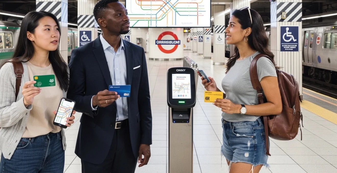
Metrocard and OMNY contactless payment systems
New York’s fare system is currently transitioning from the long-established MetroCard to the newer OMNY contactless payment system. MetroCards are magnetic stripe cards that you swipe at the turnstile, available in pay-per-ride and unlimited ride formats. OMNY, by contrast, allows you to tap a contactless bank card, smartphone, or wearable device at readers installed on turnstiles and buses across the city. Both systems currently operate in parallel, but the long-term goal is for OMNY to replace MetroCards entirely, simplifying fare payment and reducing the need for physical ticket vending machines.
For visitors, OMNY offers several advantages, including automatic fare capping that ensures you will not pay more than the cost of an equivalent unlimited MetroCard over a set period when using the same card or device. You no longer need to decide in advance how many rides you will take; instead, you can pay as you go and let the system optimise your costs. If you prefer a more traditional approach or do not have a contactless-enabled card, MetroCards remain widely available at station machines and staffed booths. Regardless of your choice, always use the same card or device for each trip to ensure accurate fare calculation and avoid duplicate charges.
Manhattan transfer hubs: times square-42nd street complex
The Times Square–42nd Street complex is one of the most important transfer hubs in the New York City Subway system, linking multiple lines including the 1, 2, 3, 7, N, Q, R, W, and S (Shuttle) services. Spread across several interconnected underground levels, the complex functions like a central terminal for midtown Manhattan, providing access to both north–south and east–west routes. Navigating this hub can feel daunting at first, with long passageways, multiple stairways, and overlapping signage. However, once you understand that the station is organised by corridor rather than by a single central concourse, moving between lines becomes more intuitive.
To streamline transfers at Times Square–42nd Street, follow the coloured line symbols and route letters or numbers rather than relying solely on station names. Overhead signs clearly indicate walking times between platforms, often listing them as “2 minutes” or “5 minutes,” which helps set realistic expectations for transfers. The 42nd Street Shuttle (S) provides a direct cross-town connection to Grand Central–42nd Street, making it a crucial link for travellers heading to Metro-North Railroad services. If you imagine the hub as a series of tunnels radiating from a central spine, you can choose the shortest route between platforms without unnecessary backtracking.
Brooklyn and queens borough connectivity via 4-5-6 lines
The 4, 5, and 6 lines form the core of the Lexington Avenue corridor in Manhattan, extending into the Bronx and providing indirect connectivity to Brooklyn and Queens through transfer points. While the 4 and 5 offer express services along much of their Manhattan route, the 6 functions primarily as a local service, stopping at more stations. To reach Brooklyn from Manhattan using these lines, you typically transfer at major hubs such as Brooklyn Bridge–City Hall or Fulton Street to cross-river services on lines like the 2, 3, A, C, or R. For Queens-bound journeys, connections are often made via Grand Central–42nd Street or 59th Street–Lexington Avenue, where transfers to the 7, N, R, or W lines are available.
Understanding these transfer relationships is key to efficient cross-borough travel. Rather than thinking of the 4-5-6 as direct routes to every outer borough destination, see them as high-capacity spines that feed into a network of intersecting lines. This is similar to major arteries in a road network that connect with ring roads and smaller streets. When planning journeys between Brooklyn and Queens, you may sometimes find it faster to remain on a single line that crosses both boroughs, but in many cases, a carefully timed transfer involving the 4-5-6 corridor and another line offers the optimal balance between speed and simplicity.
Weekend service changes and track work notifications
Weekend service changes and track work are an integral part of New York City Subway operations, reflecting the need to maintain and upgrade infrastructure while minimising disruption during peak weekday periods. These changes can involve rerouted trains, skipped stations, or line suspensions, often concentrated on nights and weekends. Before setting out, it is essential to consult the Metropolitan Transportation Authority (MTA) website, station posters, or mobile apps that provide real-time updates on planned service changes. Many platforms display electronic boards that summarise current disruptions and suggest alternative routes.
To navigate these changes effectively, adopt a flexible mindset and have at least one backup route in mind for longer journeys. If your usual line is subject to track work, you may be directed to use a different train that runs express over certain sections or a shuttle bus that replaces rail service between specific stations. Think of these adjustments like temporary detours on a highway: they may add a few minutes to your trip but are designed to keep the overall network functioning. By allowing a little extra travel time on weekends and checking live service information before you tap into the system, you can avoid surprises and maintain control over your itinerary.
Mobile applications and real-time transit information systems
Across Tokyo, London, and New York, mobile applications and real-time transit information systems have become indispensable tools for navigating complex subway networks. Official apps, such as Tokyo Metro’s navigation app, Transport for London’s TfL Go, and the MTA’s TrainTime and MYmta, offer route planning, live service updates, and station accessibility information. Third-party apps, including global platforms like Citymapper and Google Maps, integrate schedule data with walking directions and alternative transport options. By combining real-time information with predictive journey planning, these tools help you adapt to delays, choose the fastest routes, and avoid overcrowded lines.
When selecting a transit app, consider features such as offline map availability, multi-language support, and the ability to save frequent journeys. Many apps allow you to receive push notifications about service disruptions on specific lines or stations you designate as favourites, effectively turning your phone into a personalised control centre for urban mobility. In dense city environments where GPS signals can occasionally falter, station-based wayfinding combined with app-based route confirmation provides a robust navigation strategy. By treating mobile apps as dynamic companions rather than static maps, you can make informed decisions in real time, whether you are commuting to work or exploring a new neighbourhood.
Underground signage interpretation and wayfinding techniques
Effective wayfinding in subway systems relies on quickly interpreting a layered set of visual cues, including colour coding, symbols, arrows, and typography. Tokyo, London, and New York all use distinct design languages, yet share common principles: line colours remain consistent across maps, signs, and platform indicators; station names are prominently displayed; and directional arrows guide flows of passengers. Learning to “read” these systems is akin to learning a new alphabet—once you recognise the patterns, you can decode complex layouts at a glance. For example, following the familiar roundel logo in London or the JR emblem in Tokyo immediately orients you towards specific operators and services.
Practical wayfinding techniques include always checking overhead signs before descending stairs, confirming both the line name and direction, and noting the final destination of the train you plan to board. In large interchange stations, pay attention to intermediate waypoints indicated on signs, such as “towards East Exit” or “towards North Concourse,” which can help you choose the correct corridor long before you reach your platform. Floor markings, including coloured stripes or arrows, are increasingly used to guide transfer paths, especially in Japanese stations, functioning like painted trails in a national park. By consciously combining map reading with on-the-ground signage interpretation, you build a mental model of the system that makes subsequent journeys smoother and less stressful.
Emergency protocols and accessibility features across global networks
Despite their complexity, major subway systems share a fundamental commitment to passenger safety, reflected in clearly defined emergency protocols and expanding accessibility features. Emergency intercoms, alarm levers, and evacuation signage are standard elements across Tokyo, London, and New York networks, typically located near doors and at regular intervals along platforms. Before your train arrives, it is worth noting the position of emergency equipment in case you need to use it or direct someone else during an incident. Public address systems and digital displays provide real-time instructions during disruptions, ranging from minor delays to service suspensions or station evacuations.
Accessibility features have improved significantly in recent years, with more stations offering step-free access, tactile paving, audible announcements, and visual displays for passengers with mobility, visual, or hearing impairments. In Tokyo, many newer stations include elevators, platform edge doors, and multilingual announcements; London’s TfL publishes detailed accessibility maps showing which stations are step-free from street to platform or train; and New York’s MTA continues to retrofit older stations with lifts and tactile strips. If you rely on specific accessibility support, planning your route in advance using official accessibility guides and apps is crucial, as not all stations offer the same level of facilities.
In the event of an emergency, the most important principles are to remain calm, follow staff instructions, and move away from danger zones such as platform edges or crowded stairways. If a train stops unexpectedly in a tunnel, doors will usually remain closed until authorised staff can manage any evacuation, and intercoms allow communication with the operator. Just as you might scan for fire exits when entering a theatre or hotel, taking a few moments to identify exits, help points, and accessible routes when you arrive at a station prepares you for unexpected situations. By combining awareness of emergency protocols with knowledge of accessibility features, you make your use of global subway systems not only more efficient, but also significantly safer and more inclusive.