South America stands as one of Earth’s most spectacular continents, offering an extraordinary tapestry of natural landscapes that captivate travellers and nature enthusiasts alike. From the towering granite spires of Patagonia to the vast expanse of the Amazon rainforest, this remarkable landmass encompasses virtually every type of ecosystem imaginable. The continent’s diverse geography spans dramatic mountain ranges, pristine wetlands, ancient salt flats, and coastal formations that have evolved over millions of years. Each destination presents unique opportunities to witness nature’s grandest displays, whether through the thunderous calving of glaciers, the intricate dance of endemic wildlife, or the surreal beauty of high-altitude deserts. These natural wonders continue to attract researchers, photographers, and adventurers seeking to experience some of the planet’s most pristine and awe-inspiring environments.
Patagonian wilderness: torres del paine and los glaciares national parks
The southern reaches of South America harbour some of the world’s most dramatic wilderness areas, where ancient geological forces have sculpted landscapes of unprecedented beauty. Patagonian wilderness encompasses vast territories across both Chile and Argentina, featuring pristine national parks that protect extraordinary ecosystems. These protected areas serve as crucial corridors for wildlife migration and offer visitors unparalleled access to some of the continent’s most spectacular natural phenomena.
Granite spires and glacial formations in torres del paine
Torres del Paine National Park showcases three magnificent granite towers that rise abruptly from the Patagonian steppes, creating one of the most photographed mountain formations in South America. These ancient spires, formed through millions of years of glacial activity and erosion, reach heights of over 2,800 metres and dominate the surrounding landscape with their imposing presence. The park’s diverse terrain encompasses glacial lakes of brilliant turquoise, extensive grasslands where guanacos roam freely, and dense forests that provide habitat for endangered species such as the Andean deer.
The interplay between ice and rock continues to shape this remarkable landscape, with numerous glaciers feeding pristine lakes and rivers throughout the region. Grey Glacier, one of the park’s most accessible ice formations, demonstrates the dynamic nature of Patagonian glaciology as visitors can witness the dramatic process of ice calving into Lago Grey. The surrounding ecosystem supports over 100 bird species, including the magnificent Andean condor, which utilises thermal currents generated by the granite formations to soar effortlessly above the peaks.
Perito moreno glacier dynamics and calving phenomena
Perito Moreno Glacier represents one of the few advancing glaciers remaining on Earth, defying the global trend of glacial retreat whilst providing spectacular displays of ice dynamics. This massive ice formation spans approximately 250 square kilometres and reaches the waters of Lago Argentino, where it creates a natural dam that periodically ruptures in dramatic fashion. The glacier’s unique behaviour results from its steep gradient and the specific climatic conditions of the Southern Patagonian Ice Field.
The calving phenomena at Perito Moreno create thunderous displays as house-sized blocks of ice crash into the turquoise waters below. These events occur regularly throughout the day, producing sounds that can be heard from kilometres away and creating temporary icebergs that drift slowly across the lake. Scientists monitor the glacier’s movement using sophisticated GPS technology, recording advance rates of up to two metres per day during active periods. The glacier’s face, standing nearly 60 metres above the water surface, provides visitors with an accessible vantage point to observe these magnificent natural processes in action.
Cerro fitz roy alpine photography techniques
Cerro Fitz Roy, known locally as Chaltén or “smoking mountain” due to the clouds that frequently shroud its summit, presents some of the most challenging and rewarding photographic opportunities in Patagonia. The mountain’s jagged profile and technical climbing routes have made it an icon of alpine adventure, whilst its dramatic lighting conditions create exceptional opportunities for landscape photography. The peak’s granite face catches the first and last light of day, producing the famous “alpenglow” effect that transforms the rock into brilliant shades of orange and pink.
Optimal photography conditions occur during the brief summer months when extended
daylight hours and clearer skies improve visibility of the surrounding granite spires and glacial valleys. To capture the best images of Cerro Fitz Roy, photographers often base themselves in El Chaltén and hike pre-dawn to classic viewpoints such as Laguna de los Tres. Using a sturdy tripod and shooting with a low ISO helps preserve detail in the subtle tones of the rock and sky, while a graduated neutral-density filter can balance the bright horizon against darker foreground elements. Winter and shoulder seasons may bring more volatile weather, but the interplay of snow squalls and fleeting sunlight can reward patient observers with truly unique compositions.
When planning an alpine photography expedition in this region, it is important to account for rapidly changing weather and high winds that can affect both visibility and equipment stability. Layered clothing, weather-sealed camera bodies, and lens cloths to manage condensation are essential. Many professionals recommend scouting locations during the afternoon and marking safe return routes in advance, as trails can become difficult to follow in low light. By combining careful planning with a flexible approach to the elements, you increase your chances of capturing those iconic images that define Patagonia’s wild character.
Valdés peninsula marine wildlife corridors
On Argentina’s Atlantic coast, the Valdés Peninsula functions as a crucial marine wildlife corridor and one of South America’s most important coastal sanctuaries. This UNESCO World Heritage Site protects extensive coastal cliffs, sheltered bays, and offshore waters that host breeding colonies of southern right whales, elephant seals, and Magellanic penguins. The unique shape of the peninsula creates natural nurseries where whales arrive between June and December to calve and nurse their young in relatively calm seas. For visitors, these seasonal movements provide rare opportunities to observe large marine mammals at close range while supporting conservation-focused tourism.
The peninsula’s terrestrial habitats are equally significant, with steppe grasslands supporting guanacos, maras, and a range of bird species that move between land and sea. Conservation biologists study Valdés as a living laboratory for understanding how migratory species use coastal corridors and how climate change may alter their routes over time. Boat excursions from Puerto Pirámides, guided coastal walks, and designated viewpoints allow you to experience this dynamic ecosystem with minimal disturbance to wildlife. Adhering to local regulations on viewing distances and noise levels ensures that these fragile breeding grounds remain viable for future generations of marine life and travellers alike.
Amazonian basin biodiversity hotspots and riverine ecosystems
The Amazonian basin encompasses the largest tropical rainforest on the planet, spanning nine countries and covering an area of more than six million square kilometres. This vast region contains an estimated 10% of all known species, making it a global hotspot for biodiversity and a vital regulator of Earth’s climate. Its intricate network of rivers, tributaries, and flooded forests supports complex ecological interactions that scientists are still working to fully understand. For travellers seeking breathtaking natural scenery, the Amazon offers encounters with extraordinary wildlife, towering canopy layers, and traditional communities that have lived in balance with their environment for centuries.
Exploring the Amazon’s riverine ecosystems reveals how seasonal flooding shapes both landscape and life. During the high-water months, forests become submerged, fish migrate into newly formed channels, and tree-dwelling mammals adapt to an aquatic world beneath their branches. In the low-water season, exposed sandbars and riverbanks provide feeding grounds for birds and basking sites for reptiles. Whether you are gliding silently in a canoe at dawn or listening to the nocturnal chorus from a jungle lodge, the Amazon immerses you in one of the most dynamic natural environments on Earth.
Pacaya-samiria national reserve flooded forest systems
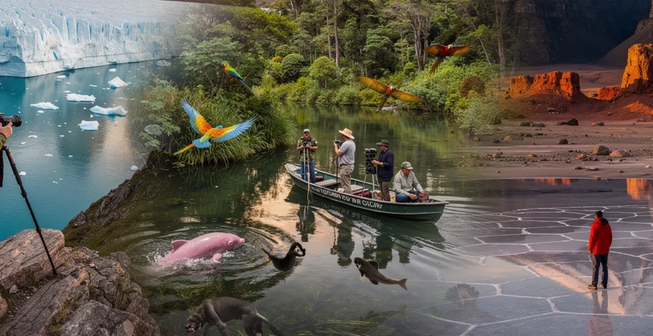
Located in northeastern Peru, Pacaya-Samiria National Reserve is one of the largest protected areas in the Amazon basin and a premier destination for experiencing flooded forest systems. Often referred to as the “jungle of mirrors,” the reserve’s blackwater rivers reflect the canopy above, creating ethereal scenes that are a dream for photographers and nature lovers. Seasonal inundation can cover more than 80% of the reserve, transforming terrestrial pathways into navigable waterways and reshaping habitat availability for fish, amphibians, and aquatic birds. This cyclical flooding is essential to nutrient distribution and supports some of the highest fish biomass recorded in the Amazon.
Visitors typically explore Pacaya-Samiria via multi-day river expeditions, staying on small cruise vessels or community-run lodges that provide access to remote lagoons and oxbow lakes. Guided excursions at different times of day reveal how wildlife activity shifts with the light and water levels, from pink river dolphins surfacing at sunrise to caimans patrolling dark channels at night. For responsible travellers, choosing operators that collaborate with local communities and support scientific monitoring helps ensure that increased tourism contributes positively to conservation goals. Packing lightweight, quick-drying clothing and waterproof storage for electronics is crucial, as you will likely be stepping in and out of boats in humid, unpredictable conditions.
Tambopata research centre canopy layer exploration
In southeastern Peru, the Tambopata region has become synonymous with cutting-edge rainforest research and immersive ecotourism. The Tambopata Research Centre (TRC) lies deep within a protected area, several hours upriver from the nearest town, offering rare access to intact primary forest and its intricate canopy layer. Researchers and visitors alike are drawn to this site by its proximity to one of the world’s largest clay licks, where hundreds of macaws and parrots gather to consume mineral-rich soils that help neutralise dietary toxins. This spectacular daily ritual provides both striking visual displays and valuable data on parrot health, behaviour, and migration.
Canopy platforms and suspension bridges at lodges near TRC allow you to experience the rainforest from the perspective of epiphytes, bromeliads, and arboreal mammals. Climbing into the canopy at dawn reveals flocks of tanagers, toucans, and mixed-species bird groups that rarely descend to the forest floor. From an ecological perspective, observing life in the canopy is like visiting a second forest growing above the first, with specialised species and microclimates. Safety briefings, harness systems, and guided supervision are standard, making canopy exploration accessible even for those with limited climbing experience. By participating in citizen-science activities such as wildlife counts or camera-trap checks, you can contribute directly to ongoing conservation research.
Manu biosphere reserve endemic species distribution
The Manu Biosphere Reserve, also in Peru, is frequently cited as one of the most biodiverse places on the planet, with some studies reporting more than 1,000 bird species and hundreds of mammal species within its boundaries. This UNESCO-designated reserve spans an elevational gradient from Andean cloud forests to lowland Amazon basin, creating a mosaic of habitats that support an exceptional range of endemic species. Because of this altitudinal diversity, scientists can study how temperature, rainfall, and habitat type influence species distribution, offering critical insights into how climate change may affect tropical ecosystems.
For visitors, Manu offers a rare chance to follow the same altitudinal journey, starting in orchid-rich cloud forests and descending into the humid lowlands. Along the way, you might encounter Andean cock-of-the-rock leks, giant river otters patrolling oxbow lakes, and troops of woolly or spider monkeys moving through the canopy. Access is carefully regulated, and much of the core zone is reserved for scientific research and indigenous communities, which helps preserve its pristine character. Joining a reputable tour operator that emphasises small groups and low-impact practices ensures that your presence supports conservation while allowing you to witness one of South America’s most extraordinary natural theatres.
Anavilhanas archipelago fluvial island formation
In Brazil’s Amazonas state, the Anavilhanas Archipelago represents one of the world’s largest river archipelagos, with more than 400 islands scattered along a stretch of the Rio Negro. These fluvial islands are formed by the gradual deposition of sediments carried by powerful river currents, creating an ever-changing maze of channels, sandbars, and forested islets. During the wet season, rising waters submerge many of the islands, allowing aquatic species to disperse and colonise new habitats. In the dry season, exposed beaches become nesting sites for turtles and resting areas for migratory birds.
Cruising through the Anavilhanas Archipelago offers a striking contrast to the muddy mainstem of the Amazon River. The Rio Negro’s dark, tannin-rich waters support fewer mosquitoes and create mirrored reflections of the surrounding forest, enhancing the sense of immersion in an endless green corridor. Small boat excursions at dawn and dusk are ideal for spotting pink and grey river dolphins, as well as for listening to the calls of howler monkeys echoing across the water. To navigate this labyrinth safely, local guides rely on intimate knowledge of seasonal water levels and submerged hazards. For travellers, respecting no-go zones and protected nesting areas is essential to preserving the delicate balance of this riverine ecosystem.
Andean high-altitude landscapes and volcanic formations
The Andean cordillera forms the backbone of South America, stretching more than 7,000 kilometres from Venezuela to southern Chile and Argentina. This colossal mountain chain hosts an array of high-altitude landscapes, from windswept puna grasslands to snow-capped volcanic cones and crystalline salt flats. These environments may appear harsh at first glance, but closer inspection reveals finely tuned ecological communities adapted to low oxygen levels, intense solar radiation, and dramatic temperature swings. Travelling through Andean regions gives you access to some of the continent’s most photogenic and scientifically significant destinations, where geology and climate combine to create otherworldly scenery.
Volcanic activity has shaped much of the Andean topography, leaving behind stratovolcanoes, geothermal fields, and mineral-rich deposits that colour entire valleys. Meanwhile, the interplay of evaporation and ancient lakes has produced vast salt flats that serve as natural laboratories for studying mineral crystallisation and even testing equipment for future Mars missions. Whether you are hiking along canyon rims or standing on an endless expanse of white salt under a cobalt sky, the Andes continually remind you of the powerful forces that sculpt our planet.
Salar de uyuni mineral crystallisation patterns
Salar de Uyuni in Bolivia is the world’s largest salt flat, covering more than 10,000 square kilometres at an elevation of about 3,650 metres. This immense plateau was once part of a prehistoric lake that gradually evaporated, leaving behind thick deposits of halite and other evaporite minerals. Over time, repeated cycles of flooding and drying have produced geometric mineral crystallisation patterns that appear as vast hexagonal tiles stretching to the horizon. Walking across the salar feels like traversing a frozen sea, yet the surface is composed of salt crust several metres thick, beneath which brine layers rich in lithium and other minerals are found.
During the rainy season, a shallow film of water transforms Salar de Uyuni into a giant mirror that perfectly reflects the sky, creating one of South America’s most surreal natural spectacles. This reflective effect is so precise that it has been used to calibrate satellite altimeters. For visitors, the challenge lies in managing altitude, exposure to intense sunlight, and rapid temperature changes between day and night. Planning excursions with experienced guides, carrying sufficient water, and using high-factor sunscreen and sunglasses helps mitigate these risks. If you are interested in photography, the salar’s uniform surface is ideal for playing with perspective and scale, resulting in creative images that seem to defy reality.
Atacama desert extreme aridity geological features
The Atacama Desert in northern Chile is recognised as one of the driest non-polar regions on Earth, with some weather stations reporting no measurable rainfall for decades. This extreme aridity has preserved geological formations and mineral deposits in remarkable condition, making the Atacama a favourite destination for geologists and astronomers alike. Vast salt flats, wind-sculpted rock formations, and volcanic peaks define a landscape that has often been compared to the surface of Mars. In fact, NASA has conducted tests here for rover technologies and life-detection instruments intended for future planetary missions.
Key sites such as the Valle de la Luna (Valley of the Moon) showcase gypsum and salt crusts, layered sedimentary rocks, and towering dunes that glow in warm hues at sunrise and sunset. At higher elevations, lagoons framed by snow-capped volcanoes provide habitat for Andean flamingos, whose presence adds an unexpected splash of colour to the stark environment. Despite its harshness, the Atacama offers comfortable base towns like San Pedro de Atacama, from which you can join guided tours to geyser fields, hot springs, and high-altitude observatories. Because of the region’s clear skies and minimal light pollution, stargazing here ranks among the best in the world; bringing or borrowing binoculars can turn a casual night under the stars into a transformative astronomical experience.
Colca canyon thermal uplifts and condor migration routes
Colca Canyon in southern Peru is one of the deepest canyons on the planet, plunging to depths of more than 3,000 metres in places. This immense chasm has been carved over millions of years by the Colca River, creating terraced slopes that have supported human agriculture since pre-Inca times. More recently, Colca has gained fame as a prime location for observing the Andean condor, one of the world’s largest flying birds. These majestic raptors use the canyon’s powerful thermal uplifts to gain altitude with minimal effort, soaring along established migration and foraging routes that often bring them close to designated viewpoints such as Cruz del Cóndor.
For visitors, early morning is usually the best time to see condors taking advantage of rising warm air as the sun heats the canyon walls. Watching a condor glide silently overhead, with wingspans that can exceed three metres, is an unforgettable experience for birdwatchers and casual observers alike. Multi-day hikes into the canyon allow you to explore its microclimates, from cactus-dotted slopes to lush valley floors with fruit orchards and hot springs. However, the steep ascents and high elevation require good physical conditioning and careful pacing. Local guides can help set realistic itineraries and share insights into the traditional lifestyles of the communities that still farm the ancient terraces.
Cotopaxi stratovolcano glacial retreat monitoring
Cotopaxi, one of Ecuador’s most iconic peaks, is a classic stratovolcano rising to 5,897 metres above sea level. Its near-symmetrical cone and year-round snowcap have made it a symbol of the country’s highland region and a magnet for climbers and photographers. Yet in recent decades, Cotopaxi’s glaciers have shown clear signs of retreat, mirroring a broader trend across tropical mountain ranges. Scientists monitor these changes using satellite imagery, GPS surveys, and on-the-ground measurements of ice thickness and meltwater flow, providing valuable data on how climate warming is reshaping high-altitude environments.
Travellers can experience Cotopaxi’s dramatic scenery without attempting a technical summit ascent. The national park offers accessible trails that lead to viewpoints on the volcano’s lower slopes, as well as high-altitude refuges where you can acclimatise and observe the surrounding páramo ecosystem. Here, hardy grasses, cushion plants, and specialised birds such as the carunculated caracara thrive in cold, windy conditions. Park regulations emphasise staying on marked paths and minimising disturbance to fragile vegetation, which regenerates slowly at these elevations. By visiting with knowledgeable guides, you gain a deeper understanding of how glacial retreat affects local water supplies, agriculture, and the long-term stability of volcanic slopes.
Atlantic coastal morphology and marine protected areas
South America’s Atlantic coastline stretches from tropical mangroves in northern Brazil to the windswept shores of Argentine Patagonia, showcasing an impressive array of coastal landforms. Over millennia, waves, tides, and currents have sculpted barrier islands, estuaries, dune systems, and rocky headlands that host rich marine and bird life. Coastal morphology in this region is not just a subject for geomorphologists; it directly influences fish nurseries, turtle nesting beaches, and the productivity of nearshore ecosystems that support local communities. In response to growing environmental pressures, several countries have established marine protected areas (MPAs) to safeguard key habitats and species.
Brazil’s Abrolhos Marine National Park, for example, protects the largest coral reef system in the South Atlantic and serves as a calving ground for humpback whales. Further south, Argentina’s marine parks along the Patagonian coast help conserve foraging grounds for penguins, sea lions, and seabirds that depend on nutrient-rich upwelling zones. When you visit these protected areas, you participate in a broader shift towards sustainable tourism, where guided whale-watching excursions, regulated diving trips, and educational centres replace more extractive coastal activities. Observing no-anchor zones, respecting wildlife approach distances, and supporting operators with clear conservation commitments are simple steps that allow you to enjoy South America’s Atlantic seascapes while contributing to their long-term protection.
Cloud forest ecosystems and montane biodiversity corridors
Cloud forests form one of the most enchanting and biologically rich ecosystems in South America, typically occurring along Andean slopes between 1,500 and 3,000 metres in elevation. Perpetually bathed in mist and low-lying clouds, these forests support a profusion of mosses, orchids, bromeliads, and epiphytes that cloak tree trunks and branches in green. The constant moisture and relatively stable temperatures create ideal conditions for endemic amphibians, hummingbirds, and insects, many of which are found nowhere else on Earth. Because cloud forests often straddle national borders and span different altitude zones, they act as critical montane biodiversity corridors that allow species to move in response to climate and habitat changes.
Destinations such as Ecuador’s Mindo region, Colombia’s Cocora Valley, and Bolivia’s Yungas provide accessible gateways into these magical environments. Well-marked trails and canopy towers offer vantage points to observe mixed-species bird flocks, elusive tapirs, and dazzling butterflies fluttering along forest edges. At the same time, cloud forests are among the most threatened ecosystems due to deforestation, road construction, and shifting agricultural frontiers. Supporting community-led reserves, staying at ecolodges that invest in habitat restoration, and participating in guided night walks to spot frogs and nocturnal mammals are all ways to deepen your connection with these landscapes while helping to secure their future. As you walk through the mist, you may find yourself wondering: how many undiscovered species still hide in these moss-draped branches?
Pantanal wetland hydrology and seasonal flood dynamics
The Pantanal, spanning Brazil, Bolivia, and Paraguay, is the world’s largest tropical wetland and a haven for wildlife enthusiasts. Covering an area estimated at up to 195,000 square kilometres, this vast floodplain acts like a giant sponge, absorbing seasonal rains and overflow from surrounding rivers before gradually releasing water downstream. The region’s hydrology is governed by a predictable cycle: during the wet season, up to 80% of the Pantanal may be submerged, while in the dry season, receding waters expose grasslands, mudflats, and lagoons. These seasonal flood dynamics drive one of the most impressive wildlife spectacles in South America, concentrating fish, caimans, capybaras, and predators such as jaguars into accessible areas.
For travellers, timing a visit to the Pantanal involves balancing wildlife visibility with comfort. The dry season, typically from June to October, is generally recommended for spotting large mammals and birds at close range, as animals congregate around remaining water sources. Boat safaris, horseback excursions, and 4×4 drives from traditional cattle ranches (fazendas) provide a variety of perspectives on this mosaic of habitats. However, the shoulder seasons can also be rewarding, offering lush scenery and fewer visitors, with the added drama of storms building over the horizon. Regardless of when you go, choosing operators that adhere to speed limits on rivers, avoid spotlighting animals at close range for prolonged periods, and support anti-poaching initiatives helps ensure that this extraordinary wetland continues to thrive as both a wildlife sanctuary and a living cultural landscape.