The subterranean world holds some of Earth’s most extraordinary landscapes, hidden beneath our feet in vast networks of passages, chambers, and geological wonders. From the limestone karst systems carved over millions of years to volcanic lava tubes frozen in time, underground caves represent one of the last true frontiers for exploration on our planet. Whether you’re drawn to the scientific fascination of speleology, the adrenaline of wild caving expeditions, or simply the ethereal beauty of illuminated stalactites in a guided show cave, the world beneath offers experiences unlike any other adventure activity.
Cave exploration has evolved significantly from its early days when spelunkers ventured underground with little more than candles and rope. Today’s caving community combines cutting-edge technology with traditional exploration techniques, opening previously inaccessible chambers to both experienced cavers and curious travellers. Understanding the equipment requirements, geological formations, safety protocols, and destination options enables you to approach underground exploration with confidence and respect for these fragile environments.
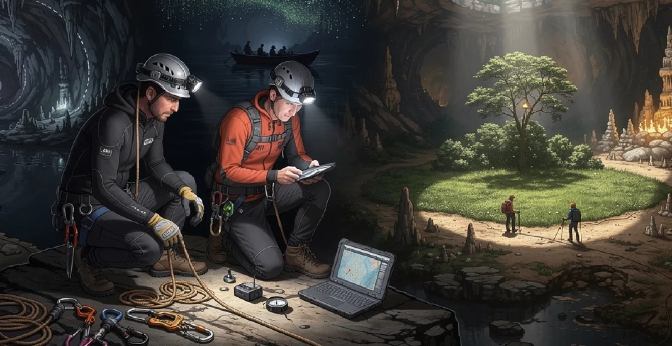
Essential speleological equipment and safety gear for cave exploration
Proper equipment represents the foundation of safe cave exploration, regardless of whether you’re embarking on a family-friendly walking tour or a technical vertical expedition. The underground environment presents unique challenges that surface gear simply cannot address adequately. Temperature regulation becomes critical when ambient cave temperatures hover between 6-10 degrees Celsius in British systems, whilst tropical caves may reach 20 degrees with near-100% humidity. Your body’s 37-degree core temperature creates a constant heat loss challenge that appropriate clothing must counteract.
The investment in quality caving equipment pays dividends in comfort, safety, and longevity. Unlike casual outdoor activities where you might improvise with household items, underground exploration demands purpose-built gear engineered for the specific stresses of subterranean environments. Water resistance, abrasion protection, impact resistance, and reliability in zero-light conditions all factor into equipment selection decisions that experienced cavers consider carefully.
Helmet-mounted LED systems and backup lighting configuration
Lighting systems have revolutionised cave exploration over the past two decades, transforming from carbide lamps and incandescent bulbs to powerful LED arrays that provide thousands of lumens whilst consuming minimal battery power. Your primary light source must be helmet-mounted to keep both hands free for climbing, scrambling, and maintaining balance across uneven terrain. Modern LED systems offer adjustable brightness settings, allowing you to conserve battery life during walking passages whilst providing maximum illumination for technical sections or photography.
The « three sources of light » rule remains fundamental to safe caving practice. Beyond your primary helmet-mounted system, you should carry a secondary headlamp or handheld torch plus a third backup light source, ensuring you’re never left in complete darkness should your main system fail. Battery life calculations should account for double your expected underground duration, and experienced cavers often carry spare battery packs for extended expeditions. Lithium-ion batteries perform better than alkaline alternatives in cold, damp cave environments, maintaining voltage output more consistently throughout their discharge cycle.
Specialised caving suits: neoprene vs. cordura fabric systems
The debate between neoprene wetsuits and cordura oversuits represents one of the most discussed equipment choices among cavers. Neoprene provides superior thermal insulation in active stream caves where you’ll spend extended periods immersed in water, trapping a thin layer of water against your skin that body heat warms. However, neoprene lacks the abrasion resistance needed for dry caves with rough limestone or lava rock surfaces. Cordura fabric oversuits, worn over thermal undersuits, offer excellent durability and freedom of movement whilst allowing moisture vapour to escape, preventing the clammy discomfort that non-breathable materials create.
Your choice depends entirely on your destination’s characteristics. British caves like Swildons Hole or Porth yr Ogof demand neoprene due to their extensive water sections, whilst dry European systems might favour cordura combinations. Many serious cavers maintain both types in their equipment arsenal, selecting appropriate gear based on trip planning research. One-piece suits prevent water and mud infiltration more effectively than separate tops and bottoms, though they reduce flexibility for temperature regulation during strenuous sections.
Layering remains the most efficient strategy underground: a moisture-wicking base layer, an insulating fleece or synthetic mid-layer, and then your chosen outer caving suit. In wet, fast-flowing systems, some cavers even combine a thin neoprene suit beneath a cordura oversuit, trading a little bulk for long-term comfort and protection. As with mountaineering, there is no single “perfect” configuration; instead, you adapt your equipment to the specific cave, season, and trip duration. When you travel, it’s wise to research local cave conditions and regulations ahead of time, as some destinations require certain types of protective clothing to minimise contamination and impact.
Rope systems, ascenders, and SRT vertical progression techniques
Once you move beyond show caves and easy walking passages, vertical progression becomes central to safe cave exploration. Single Rope Technique (SRT) is the standard method used in most of the world’s technical caves, allowing you to descend and ascend fixed ropes with remarkable efficiency. Unlike climbing gyms or via ferrata routes, there are usually no permanent ladders underground; instead, you rely on static caving ropes, specialist harnesses, and mechanical devices to negotiate shafts that can range from a few metres to hundreds of metres deep.
An SRT kit typically includes a low-profile sit harness, a chest harness, a descender (often a bobbin or rack), two ascenders, cow’s tails, and a selection of locking carabiners and rigging hardware. Static ropes with low stretch are favoured because they minimise bounce when you’re suspended over a shaft, reducing both fatigue and wear on anchors. Before attempting any vertical cave, you should learn SRT in a controlled environment—many clubs run training sessions on outdoor crags or indoor towers—so that knot passing, changeovers between ascent and descent, and passing rebelays become second nature rather than stressful puzzles in the dark.
Good rope work in caves has often been compared to “underwater mountaineering”: it is slow, precise and unforgiving of careless mistakes. You will plan your rigging in advance, choosing anchors that protect the rope from sharp edges and ensure safe, free-hanging descent lines whenever possible. Redundancy is crucial; experienced riggers use two independent anchor points wherever they can, inspect natural anchors and bolts carefully, and maintain a conservative safety margin. If you are travelling to explore vertical systems such as those in Mexico or the European Alps, confirm permit requirements and recommended rigging styles, as local conventions may differ from those at home.
Underground navigation tools: survey-grade compasses and cave mapping software
Without the sun, horizon, or stars, navigation underground relies on tools and techniques developed by generations of surveyors. At the simplest level, you will follow taped routes, permanent markers, or a guide, but as soon as you step into less-travelled passages, a reliable underground navigation system becomes essential. Survey-grade compasses and clinometers allow you to measure direction and slope of each passage, while laser rangefinders or tape measures record distances between survey stations. This process creates the backbone of accurate cave maps, which are invaluable both for science and for safe route-finding on future trips.
In recent years, digital tools have transformed cave cartography. Data collected underground can be imported into specialist cave mapping software such as Therion, Survex, or Walls, which generate plan and elevation views, 3D models, and even virtual fly-throughs of complex systems. Some teams now experiment with handheld LiDAR units and photogrammetry, capturing dense point clouds that reveal minute details of speleothems, breakdown, and water channels. While you may never lead a full survey team yourself, understanding how these tools work helps you read cave maps, plan trips, and appreciate just how intricate a major cave system can be.
Because GPS signals do not penetrate rock, you cannot rely on your phone to find the way back to the entrance. Many cavers therefore combine old-fashioned techniques—like careful observation, mental mapping, and leaving temporary, low-impact markers—with digital mapping tools used after the trip. When travelling, it’s wise to obtain the latest local cave surveys from clubs or national associations; in many regions, these are updated regularly and may include notes on hazards, restricted passages, and conservation zones that are not obvious underground.
World-renowned cave systems: from mammoth cave to son doong
If you are planning to discover underground caves while travelling, it helps to know which systems are globally recognised for their size, beauty, or scientific importance. Some cave networks have become icons of speleology, drawing researchers, photographers and adventure travellers from around the world. Others remain more remote, accessible only with specialised permits and logistics, but they still capture the imagination of anyone who has ever wondered what lies beneath the surface. Exploring these world-renowned caves, even on guided tours, offers insight into different geological processes and caving cultures across continents.
Each major cave system presents its own logistical and safety considerations, from entrance quotas and seasonal closures to mandatory guiding requirements. You may find that what counts as “wild caving” in one country is considered a standard show cave in another, reflecting different national approaches to conservation and access. As you read about the following destinations, consider not just their tourist appeal but also what they teach us about karst landscapes, underground rivers, and how we manage fragile subterranean environments in an era of growing adventure tourism.
Mammoth cave national park: navigating the world’s longest cave system
Located in Kentucky, USA, Mammoth Cave is currently recognised as the longest known cave system on Earth, with more than 680 kilometres (over 420 miles) of surveyed passage as of the mid-2020s—and new sections continue to be discovered. This enormous labyrinth formed within thick Mississippian-age limestone, shaped over millions of years by groundwater dissolving the rock along bedding planes and fractures. For travellers, this means you are not simply walking through a single tunnel but sampling a tiny part of a multi-level underground maze that spans an entire plateau. It is an ideal destination if you want to combine accessible guided tours with a deeper appreciation of speleology.
Within Mammoth Cave National Park, the National Park Service offers a range of guided tours, from short, paved-route walks suitable for families to longer, more demanding trips that include scrambling and ladders. Because the system is so vast, different tours highlight different features: some focus on historic saltpetre mining, others on decorative formations, and some on narrow canyon passages that give a taste of wild caving. Booking ahead is strongly recommended, especially in peak season, as tour capacities are limited to protect both visitors and the cave environment. For those interested in research or more technical exploration, additional permitting processes apply, and these are strictly controlled.
Waitomo glowworm caves: bioluminescent formations in new zealand’s karst landscape
On New Zealand’s North Island, the Waitomo region is renowned for its active limestone karst, riddled with sinkholes, underground streams, and richly decorated caverns. The most famous of these is the Waitomo Glowworm Cave, where thousands of tiny bioluminescent larvae (Arachnocampa luminosa) transform the ceilings into what looks like a star-filled night sky. Unlike mineral formations, these “lights” are living organisms, sensitive to noise, temperature, and human disturbance, which is why the site is managed with particular care. For the travelling cave enthusiast, this is a rare chance to see a biological phenomenon that feels almost otherworldly.
Several operators in Waitomo offer different ways to experience the glowworm caves, ranging from tranquil boat rides on underground rivers to more adventurous “black water rafting” trips that involve floating in inner tubes, abseiling, and scrambling through stream passages. Even the more extreme tours are carefully structured and guided, making them accessible to relatively fit beginners who want a first taste of wild caving techniques. Because these caves are part of a delicate ecosystem, strict biosecurity measures are in place; you may be asked to clean footwear or equipment to prevent introducing invasive species or pathogens. As with many cave destinations, respecting these rules is part of practising responsible speleotourism.
Son doong cave vietnam: accessing the planet’s largest underground chamber
Discovered in the 1990s by a local farmer and surveyed in detail by British cavers in 2009, Son Doong in Vietnam’s Phong Nha–Ke Bang National Park is widely considered the largest known cave passage by cross-sectional area. Its main chamber is so vast that it could comfortably house a city block of skyscrapers or a Boeing 747 flying through without touching the walls—analogies that help convey its unimaginable scale. Inside, collapsed sections of the roof have created skylights, allowing jungle vegetation to grow hundreds of metres underground and producing an environment that feels like a lost world. For many cavers and adventure travellers, Son Doong sits at the top of the global bucket list.
Access to Son Doong is tightly regulated; only a limited number of multi-day expeditions operate each year, all accompanied by specialist guides, porters, and safety staff. These trips are closer to high-altitude trekking than to a standard show cave tour, involving river crossings, camping inside the cave, and traversing large boulder piles under time constraints and environmental guidelines. Because of the expedition-level logistics and the need to keep group sizes small, prices are high and waiting lists long. Yet for those who make the journey, the experience offers a powerful reminder of how much of our planet’s interior remains unexplored, and why strict conservation measures are justified in such unique environments.
Carlsbad caverns and the big room: exploring new mexico’s limestone masterpiece
Carlsbad Caverns National Park in New Mexico, USA, showcases some of the most spectacular speleothem formations accessible to the general public. The highlight is the Big Room, one of the largest known underground chambers in North America by both floor area and volume, filled with stalactites, stalagmites, flowstone draperies, and delicate features such as soda straws and helictites. Unlike some rugged cave systems, Carlsbad combines dramatic geology with relatively easy access: a lift and paved trails mean that visitors with limited mobility can still experience a significant part of the subterranean landscape.
For those seeking a more immersive caving experience, ranger-led “off-trail” tours explore lesser-known chambers under stricter safety and conservation rules. Seasonal evening bat flights from the natural entrance provide an additional spectacle, as hundreds of thousands of Mexican free-tailed bats spiral into the twilight sky. As with other national parks, planning is essential: check for seasonal closures, tour availability, and any new regulations related to cave-borne diseases such as white-nose syndrome in bats. Carlsbad illustrates how carefully designed infrastructure can open a limestone masterpiece to millions of visitors while still prioritising long-term preservation.
Geological classification of caves: karst, lava tubes, and sea cave formations
Understanding how different types of caves form not only enriches your travel experiences but also helps you anticipate conditions underground. A river-carved karst system in Croatia will feel very different from a lava tube in Hawaii or a sea cave in Scotland sculpted by waves. Each cave type reflects a distinct set of geological processes, rock types, and climatic influences, shaping everything from passage size and stability to the presence of speleothems and underground life. When you learn to “read” these clues, the cave becomes less of a mystery and more of a storybook written in stone.
Most natural caves fall into four broad geological categories: solutional karst caves in soluble rocks like limestone, dolomite, and gypsum; lava tubes formed by flowing basaltic lava; sea caves carved by coastal erosion; and glacier caves shaped by meltwater moving through ice. Some systems are hybrids, reflecting multiple overprinting processes across geological time. As you travel between cave destinations, paying attention to these differences can turn every tour or expedition into a mini geology field course, deepening your appreciation beyond surface-level sightseeing.
Limestone dissolution and karst topography development processes
Karst caves, the most common type explored by cavers and tourists alike, form primarily in limestone and other carbonate rocks that dissolve in slightly acidic water. Rainwater absorbs carbon dioxide from the atmosphere and soil, becoming a weak carbonic acid that seeps into fractures, bedding planes, and joints in the bedrock. Over tens to hundreds of thousands of years, these tiny pathways enlarge into conduits, then passages, and eventually entire cave systems with multiple levels, underground rivers, and massive chambers. This process is subtle but relentless, rather like a key slowly widening its own lock with every turn.
At the surface, karst landscapes display distinctive features such as sinkholes (dolines), disappearing streams, limestone pavements, and blind valleys where rivers vanish underground. When you visit regions like the Yorkshire Dales in the UK or the Dinaric karst in the Balkans, these surface indicators often hint at extensive caves below. Speleothems—stalactites, stalagmites, columns, flowstone, and more—form later, as mineral-rich water drips and flows through air-filled passages, depositing calcite over long timescales. For travellers, recognising karst topography can help you identify promising areas for cave tourism, hiking, and photography, even before you see a single entrance.
Volcanic lava tube formation: examining hawaii’s thurston lava tube
Lava tubes are another major cave category, formed not by dissolution but by cooling molten rock. When a basaltic lava flow moves steadily downslope, the outermost layers exposed to air and moisture cool and solidify first, creating an insulating crust. Beneath this crust, hotter lava continues to flow like a river in a pipe; if the eruption wanes or the lava drains away, an empty tunnel—or lava tube—remains. Because the process is relatively rapid in geological terms, many lava tubes preserve clear flow features, ropy textures, and skylights where the roof has collapsed.
Hawaii’s Thurston Lava Tube (Nāhuku), within Hawai‘i Volcanoes National Park, is a classic example accessible to visitors. Walking through it feels quite different from a limestone cave: the walls are smoother, the ceiling often more uniform in height, and there is usually less in the way of stalactites or dripstone formations. Instead, you may see lava benches, secondary mineral deposits, and tree-moulds where trunks were engulfed by the flow. For travelling cave enthusiasts, lava tubes offer a complementary experience to karst systems—more like walking through the frozen arteries of a volcano than through an underground river channel.
Coastal erosion and sea cave genesis: fingal’s cave case study
Sea caves form at coastlines where wave energy exploits weaknesses in cliffs—such as joints, faults, or softer rock layers—gradually hollowing out openings that can extend deep inland. Tidal action, wave refraction, and storm surge all contribute to this erosion, especially in areas with powerful swells and relatively fractured rock. Unlike most karst caves, sea caves are strongly influenced by modern sea level and may flood or empty partially with each tide cycle. For visitors, this creates dynamic lighting, sound, and spray, but also introduces serious hazards if you misjudge timing or weather.
Fingal’s Cave on the uninhabited Isle of Staffa, off Scotland’s west coast, is one of the world’s most famous sea caves. Carved into hexagonal basalt columns formed by ancient lava flows, it looks almost architectural, as if built from giant organ pipes. The cave’s size and acoustics inspired composer Felix Mendelssohn in the 19th century, and it continues to attract photographers and geologists today. Reaching Fingal’s Cave typically requires a boat trip, and landings can be weather-dependent, so flexibility is essential when planning a visit. As in many sea caves, footing can be slippery, and swell conditions can change quickly—respecting these variables is vital for a safe experience.
Glacier cave dynamics and ice formation structures
Glacier caves, sometimes called ice caves when they occur within ice rather than rock, form where meltwater channels its way through or beneath glaciers and permanent snowfields. In summer, surface streams sink into crevasses and moulins, carving tunnels that can reach all the way to the glacier’s base. Because the ice is constantly moving and melting, these caves are highly dynamic and often short-lived: passages can enlarge, collapse, or seal off within a single season. This impermanence makes glacier caves fascinating to study but demanding from a safety perspective.
Inside a glacier cave, you may encounter translucent blue ice, scalloped melt patterns, and icicle-like formations that resemble mineral speleothems but form on timescales of days or weeks rather than millennia. Temperatures hover around freezing, and there is a continual risk of falling ice, sudden flooding from meltwater pulses, or structural collapse. For this reason, glacier cave exploration should only be attempted with expert guiding and appropriate mountaineering gear. As climate change accelerates glacier retreat worldwide, opportunities to see these ephemeral underground ice structures may become rarer, adding urgency—but also ethical complexity—to glacier cave tourism.
Guided cave tours vs. wild caving expeditions: permit requirements and access protocols
When you set out to discover underground caves while travelling, one of the first decisions you face is whether to join a guided cave tour or pursue a wild caving expedition. Both approaches can be rewarding, but they differ sharply in terms of responsibility, risk, and regulatory oversight. Guided tours are typically designed for the general public, with fixed routes, lighting, and safety infrastructure, whereas wild caving requires you to manage your own equipment, navigation, and emergency planning. Understanding this spectrum will help you choose experiences that match your skills and expectations.
In many countries, access to caves is governed by a mix of landowner permissions, national park regulations, and agreements negotiated by local caving organisations. Some high-profile caves operate on a permit-only basis to limit visitor numbers and protect sensitive formations or endangered species like bats. For travellers, this means that research and advance booking are crucial, especially if you hope to visit flagship caves such as Son Doong, certain sections of Mammoth Cave, or restricted systems in Europe and Australasia. Arriving at a caving region without prior planning can lead to disappointment if key sites are already fully booked or off-limits.
Guided show caves provide an excellent entry point for most people and are an ethical way to support conservation through tourism revenue. They adhere to established access protocols: fixed paths reduce impact on cave floors, lighting is designed to minimise algae growth, and group sizes and visit durations are carefully controlled. You benefit from knowledgeable guides who can explain geological and historical features while also ensuring that basic safety rules—such as not touching speleothems—are followed. For families or those new to underground environments, a series of show-cave visits across different countries can be an enjoyable way to compare karst, lava tubes, and sea caves with minimal risk.
Wild caving, in contrast, shifts responsibility firmly onto you and your team. You will need to check landowner permissions, seasonal restrictions, and any required permits with regional caving councils or national associations before entering a non-commercial cave. In some regions, cave rescue services expect visiting parties to be members of a recognised association, carry insurance, and file trip plans with surface contacts. Ethical wild caving also means practicing Leave No Trace principles underground: avoiding unnecessary enlargement of constrictions, staying off fragile formations, and maintaining strict biosecurity measures when moving between caves to prevent the spread of white-nose syndrome or other pathogens. If in doubt, joining a local club and participating in organised trips is the safest way to transition from show caves to genuine exploration.
Underground hazards: hypoxia, hypothermia, and flash flooding risk management
Caves are often described as “hostile to human biology” because they remove the three comforts we take for granted at the surface: light, stable footing, and predictable weather. While most guided tours manage these factors well, wild caving exposes you to a broader array of underground hazards that must be understood and mitigated. Hypoxia (low oxygen), hypothermia (dangerously low body temperature), and flash flooding are three of the most serious risks, and they can escalate quickly if you are unprepared. Treating cave exploration like mountaineering in the dark—with comparable respect and planning—is a useful mindset.
Hypoxia occurs when oxygen levels in cave air drop below what humans need to function normally, sometimes accompanied by elevated carbon dioxide or other gases. This is a particular concern in old mines, poorly ventilated chambers, or caves with decomposing organic material. Symptoms can include headache, dizziness, confusion, and shortness of breath—warning signs that should never be ignored underground. Because you cannot “see” bad air, cavers in at-risk regions sometimes carry portable gas detectors to monitor oxygen and carbon dioxide levels. As a travelling caver, you should heed local advice: if locals tell you a mine or chamber has a history of bad air, the safest option is to stay out entirely.
Hypothermia is a more universal hazard, especially in systems with cold water or long durations underground. Even at a seemingly mild 10°C, wet clothing and limited movement can strip heat from your body faster than you might expect, much like staying in a cool swimming pool for hours. Managing this risk involves a combination of appropriate thermal layers, waterproof or neoprene suits where needed, and maintaining a steady pace that keeps you warm without excessive sweating. Carrying a small emergency kit—such as an insulated survival bag, high-calorie snacks, and a spare base layer—can make a critical difference if an injury or navigation error extends your trip.
Flash flooding represents perhaps the most dramatic underground hazard, particularly in active stream caves, slot-like canyon passages, or low sections near river levels. Heavy rainfall, snowmelt, or sudden upstream storms can transform harmless trickles into impassable torrents, cutting off exits and raising water levels in sumps and low crawls. Effective risk management starts long before you enter the cave: check detailed weather forecasts, understand the catchment area feeding your chosen system, and learn from local cavers which passages become dangerous in wet conditions. Once inside, be alert for signs of rising water or increased noise from upstream—if in doubt, retreat to higher, safer ground sooner rather than later.
Other hazards, such as falling rocks, unstable boulder piles, and getting lost in complex mazes, are mitigated through sound technique and conservative trip planning. Wearing a helmet at all times, using three independent sources of light, marking junctions mentally (or with low-impact, removable indicators), and maintaining clear communication within your team all reduce the likelihood of incidents. Ultimately, the same principles that govern safe alpinism—respect for the environment, realistic self-assessment, and willingness to turn back—apply equally underground. By embracing these principles, you can explore more confidently while minimising risk to yourself, your companions, and cave rescue volunteers.
Speleothem photography techniques and Low-Light documentation methods
One of the greatest rewards of travelling to underground caves is the opportunity to photograph landscapes that few people ever see directly. Yet cave photography also poses unique challenges: light levels are effectively zero, humidity can be extreme, and lenses fog easily as you move between air pockets and water-filled sections. Successful speleothem photography therefore relies on a blend of technical preparation, creative lighting, and respect for both safety and conservation. When done well, your images can document delicate formations, rare fauna, and exploration milestones in ways that inspire others without encouraging irresponsible visitation.
A basic low-light cave photography kit usually includes a robust camera with good high-ISO performance, a fast wide-angle lens, and multiple external light sources. Many cavers favour compact mirrorless cameras or rugged DSLRs stored in padded dry bags to guard against impact and moisture. Because you cannot rely on tripods in every situation—some passages are too tight or muddy—you might use lightweight mini-tripods, improvised supports on rocks, or even your own pack as a stabiliser. Long exposures are commonplace in caves, turning small LED panels or handheld flashguns into powerful tools for painting light across formations and chambers.
Lighting is both the biggest challenge and your greatest creative asset underground. Instead of a single on-camera flash, consider using off-camera lights placed strategically behind stalagmites or along passage walls to create depth and texture. Think of yourself as a stage designer: by positioning lights to skim across flowstone or backlight thin draperies, you can reveal delicate details that are invisible to the naked eye. Many cave photographers coordinate “light painting” with teammates—one person operates the camera while others move lights during the exposure, carefully avoiding hotspots or harsh shadows. As with all caving activities, constant awareness of footing and handholds is critical; no photograph is worth a fall or damage to fragile calcite.
Beyond aesthetic shots, documentation methods such as photogrammetry and structured light scanning are becoming more common in scientific speleology. By taking overlapping photographs from multiple angles and processing them with specialised software, you can generate accurate 3D models of chambers, speleothems, and archaeological remains. These virtual replicas are invaluable for monitoring changes over time, planning conservation work, or allowing virtual tours that reduce physical impact on sensitive areas. If you are interested in contributing to such projects as a travelling caver, contact local clubs or research groups; many welcome skilled photographers and are happy to provide protocols to ensure data quality.
Ethically, cave photography should always prioritise preservation over spectacle. Avoid stepping off established routes or touching formations just to achieve a better angle, and be cautious with bright continuous lighting around bats or troglobitic fauna that are adapted to darkness. When sharing images publicly, consider omitting precise cave locations or entrance coordinates for particularly vulnerable sites, a practice known as “cave location discretion.” By combining technical skill with responsible storytelling, you can help protect the very places that make underground travel so compelling—ensuring that the next generation of explorers can experience the same sense of wonder you felt when you first stepped beneath the surface.